Today we cycled from our dispersed campsite 25km before Bellevue to another dispersed campsite 45km after Ketchum. We had blue skies all day, sunny, warm day. Most of the day we have cycled on gravel roads, double-track, single-track, a a bit on pavement.
Riding statistics: on Wednesday June 5, 2024, the 28th day on the Western Wildlands Route route, it took 11:38h (07:29h moving time), between 06:35 and 18:14, to cover 101 km (62 miles), including 1241 m (4072 ft) elevation gain, with an average speed of 13 km/h (8 mph). During today's ride the average temperature was 26 °C (82 °F) with a minimum of 6 °C (42 °F) and a maximum of 48 °C (126 °F).
Totals: So far, it took 8 days, 16 hours, 14 minutes and 43 seconds of cycling time to cover 2945 km (1830 miles), including 32833 m (107725 ft) elevation gain, with an average speed of 14.4 km/h (8.9 mph).
This morning we were quick in getting the bikes ready, we left the campground around 6:30. The sun was already out and warm. Immediately we had to start our climb. Not too serious, but more than enough to get us warmed up. About 400+ meters of elevation gain in 10km. The road surface was in good shape, so it went well. About 1.5 hours to complete the climb. It was a good decision not doing it yesterday afternoon when we were tired and the wind was unbelievable strong, it would have made the climb so much more difficult than we experienced it today. After passing the top of the climb we had a nice downhill into the town of Bellevue. It is very small, and we immediately turned onto a rail-trail, that would bring us via Hailey to Ketchum. It was perfectly paved and cycling went very smooth.
I suggested to do groceries in Hailey because it has the biggest grocery store of all three towns and the most reasonable prices. Especially the next town Ketchum is known for the high prices. After getting groceries for two days, we packed it onto the bikes. Not an easy task, and the bikes weight increased quite a bit. After eating some of the food, we continued to Ketchum on the rail-trail.
We decided to have an ice cream and something to drink in Ketchum because it will take a while before we have another opportunity for that. We selected the last gas station in town. No store, it was changed to unmanned. Check Google maps dor the previous one. Also unmanned. Then the one before that. Ok, it has a store and we have see it when we passed it. We cycled back, went inside, and found out they had no ice cream because the freezer broke down. Oh boy. We did not want to spend much more time on this, so we took a cold drink before we continued our ride.
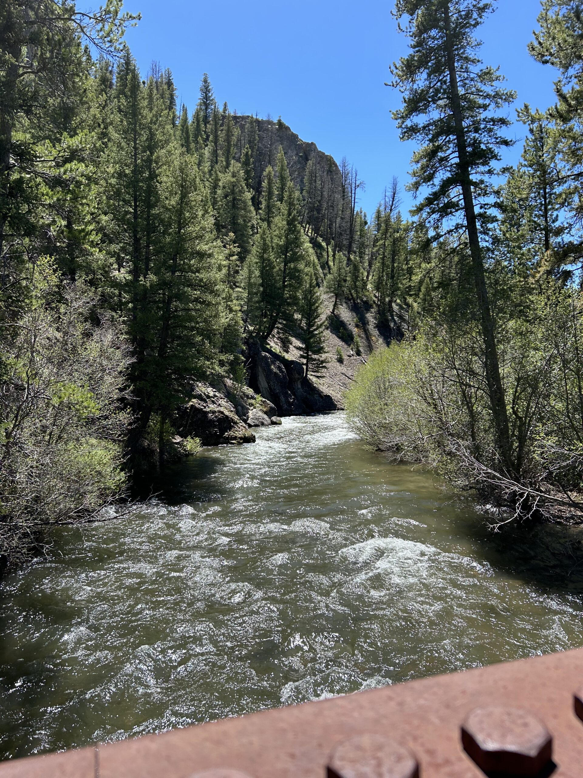
When we left Ketchum, we had to cycle 8km on the shoulder on a not too busy road. After that we took a side trail, the Harimann Trail. We both found it fantastic. It was only double-track and single-track. No motor vehicles allowed. Almost always along a river, though some meadows, and through the pine forests. We enjoyed it all 32km. The further we got, the steeper it got, but we could not care about that.
After 32km the Harimann Trail ended and we were back on the main road. It was 17:15 and we were in doubt to continue, or find a campsite at the end of the Harimann trail. I saw inbouw maps that after 2km we would go off-road again, on the so-called Old Stagecoach Route. Perfect, we surely will find a campsite along that route.
We quickly found the turn off of the min route, crossed a small stream on a simple bridge, followed a very smallmouth for about 100m, and then it ended. We searched by foot and GPS, but nonpartisan to be found. There was something that looked like it was a path long time ago, but there were dozens of dead trees across the path. So we decided to camp there and use the main road tomorrow to continue, it will bring us back on the route some kilometers further down the road. We enjoyed our food, hung the food, and went into our tents to get some sleep.
Gallery