“The Great Divide Mountain Bike Route (GDMBR) is Adventure Cycling’s premier off-pavement cycling route, crisscrossing the Continental Divide in southern Canada and the U.S. This route is defined by the word “remote”. Its remoteness equates with spectacular terrain and scenery. The entire route is basically dirt road and mountain-pass riding every day. In total, it has over 200,000 feet of elevation gain. Nearly 2,100 miles of the route is composed of County, Forest Service, Bureau of Land Management (BLM), and Canadian provincial unpaved roads.”, according to the Adventure Cycling Association.
Totals: This route took us 12 days, 21 hours, 39 minutes, and 29 seconds of cycling time to cover 4540 km (2820 miles), including 52253 m (171442 ft) elevation gain, with an average speed of 15 km/h (9 mph), reaching a maximum speed of 71 km/h (43 mph) on Wednesday, August 24, 2022. During cycling, there was a minimum temperature of 1 °C (34 °F) on Tuesday, August 16, 2022, and a maximum temperature of 58 °C (136 °F) on Tuesday, August 23, 2022.
Today we rode from a cabin at the base of the climb to Indiana Pass, Colorado, US to Horca, Colorado, US. Sunny weather with very little clouds. Road conditions included gravel roads only. Highlights of the day include climbing Indiana Pass, meeting trail angels and their support.
Riding statistics: on Friday, September 2, 2022, day 33 on the route, it took 11:17h (06:27h moving time), between 7:23 and 6:40, to cover 97 km (60 miles), including 1660 m (5446 ft) elevation gain, with an average speed of 12.0 km/h (7.5 mph), while reaching a maximum speed of 43 km/h (26.7 mph). During this ride the average temperature was 26 °C (79 °F) with a minimum of 9 °C (48 °F) and a maximum of 39 °C (102 °F).
...
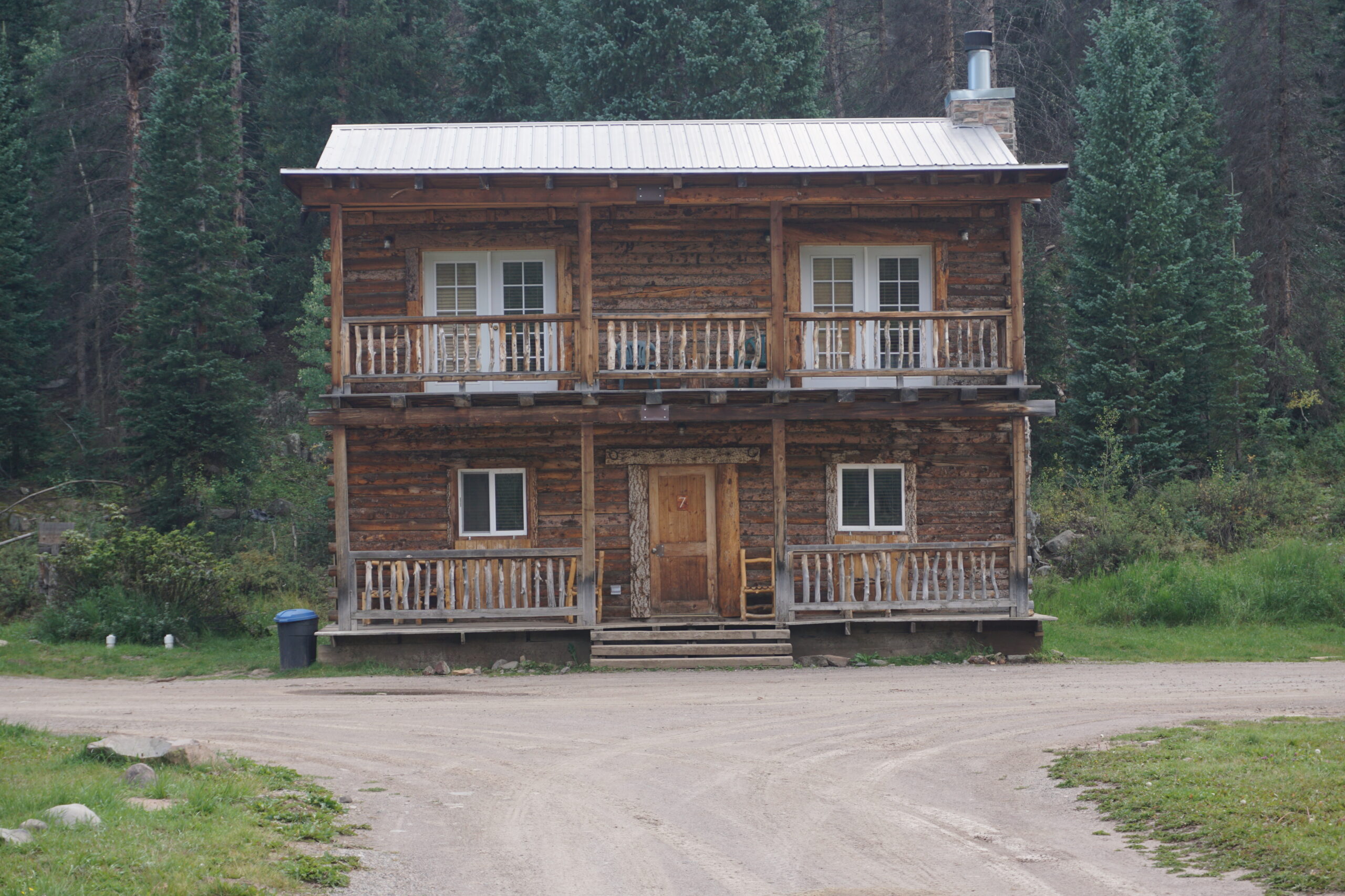
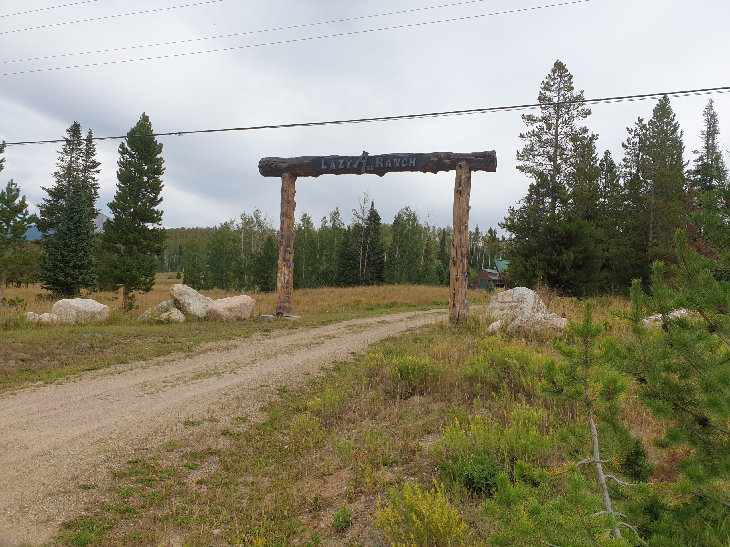
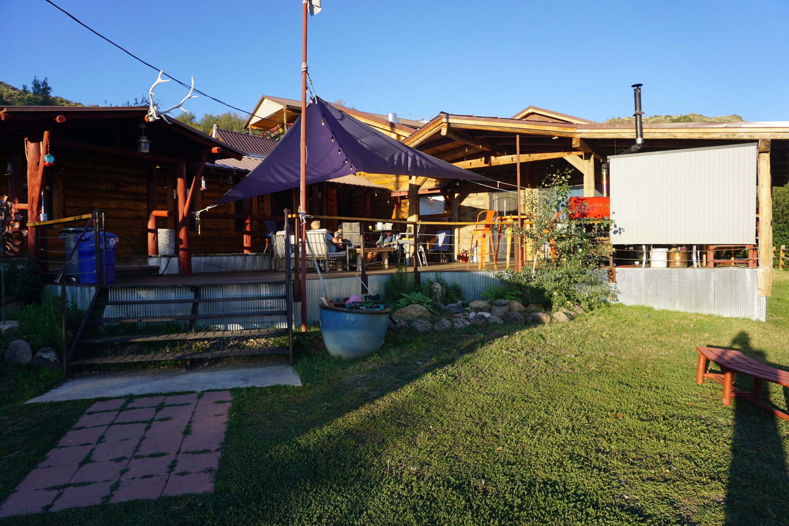
Day 32: Kevin’s Cabin
Today we rode from informal campground 8km before the top of Canero Pass, Colorado, US to a cabin at the base of the climb to Indiana Pass, Colorado, US. Sunny weather with little clouds. Road conditions included paved roads, gravel roads, and jeep tracks. Highlights of the day include climbing Canero Pass, the jeep tracks after La Garita, and the cabin were we will stay for the night.
Riding statistics: on Thursday, September 1, 2022, day 32 on the route, it took 11:17h (06:27h moving time), between 7:23 and 6:40, to cover 95 km (59 miles), including 991 m (3251 ft) elevation gain, with an average speed of 15.0 km/h (9.3 mph), while reaching a maximum speed of 47 km/h (29.2 mph). During this ride the average temperature was 27 °C (81 °F) with a minimum of 3 °C (37 °F) and a maximum of 49 °C (120 °F).
...
Day 31: No formal campground today
Today we rode from Tomichi Creek Trading Post (Sargents), Colorado, US to informal campground 8km before the to of Canero Pass, Colorado, US. Sunny weather with some clouds. Road conditions included paved roads and lots of gravel roads. Highlights of the day include climbing Cochetopa Pass and the ride up to our informal campground.
Riding statistics: on Wednesday, August 31, 2022, day 31 on the route, it took 09:02h (07:04h moving time), between 7:52 and 4:55, to cover 112 km (70 miles), including 1260 m (4134 ft) elevation gain, with an average speed of 16.0 km/h (9.9 mph), while reaching a maximum speed of 45 km/h (28.0 mph). During this ride the average temperature was 27 °C (81 °F) with a minimum of 11 °C (52 °F) and a maximum of 38 °C (100 °F).
...
Day 30: Salida
Today we rode from Salida, Colorado, US to Tomichi Creek Trading Post (Sargents), Colorado, US. Sunny weather with little clouds. Road conditions included paved roads and different sorts of gravel roads (smooth & difficult surfaces). Highlights of the day include having a lunch break on Marshall Pass and meeting all kinds of different people.
Riding statistics: on Tuesday, August 30, 2022, day 30 on the route, it took 07:42h (05:03h moving time), between 9:26 and 5:08, to cover 67 km (42 miles), including 1125 m (3691 ft) elevation gain, with an average speed of 13.0 km/h (8.1 mph), while reaching a maximum speed of 40 km/h (24.9 mph). During this ride the average temperature was 32 °C (90 °F) with a minimum of 20 °C (68 °F) and a maximum of 44 °C (111 °F).
...
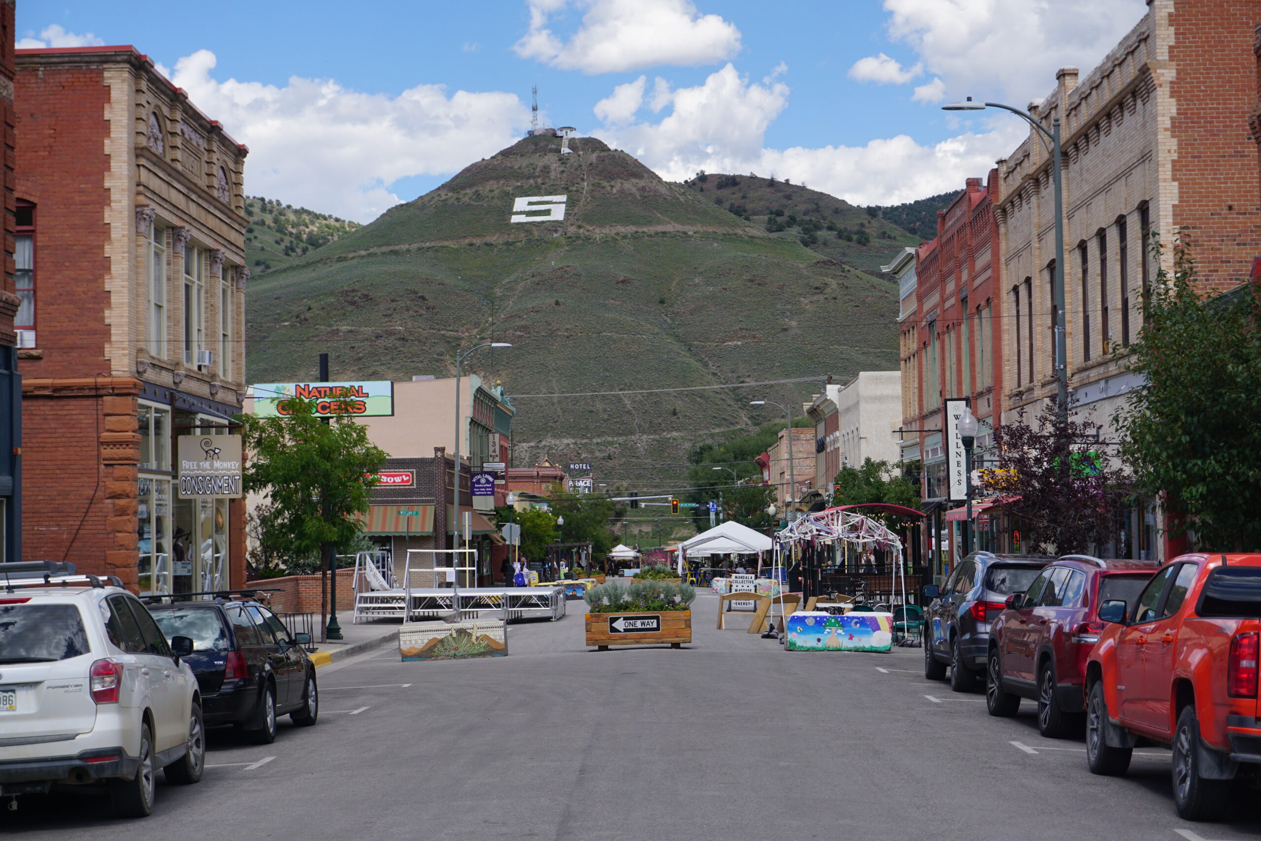
Day 29: A downtown visit
Today we rode from Hartsell, Colorado, US to Salida, Colorado, US. Sunny weather with little clouds. Road conditions included some paved roads and good gravel roads. Highlights of the day include a very good a long downhill, and the town of Salida.
Riding statistics: on Monday, August 29, 2022, day 29 on the route, it took 09:34h (05:05h moving time), between 7:27 and 5:03, to cover 81 km (50 miles), including 785 m (2576 ft) elevation gain, with an average speed of 16.0 km/h (9.9 mph), while reaching a maximum speed of 47 km/h (29.2 mph). During this ride the average temperature was 30 °C (86 °F) with a minimum of 5 °C (41 °F) and a maximum of 43 °C (109 °F).
...
Day 28: The knee says NO
Today we rode from Silverthorne, Colorado, US to Hartsell, Colorado, US. The day started with sunny weather, eventually overcast, and later thunderstorms (we have not been rained on today). Road conditions included paved roads and gravel roads. Highlights of the day include Boreas Pass (one to second highest peak on the Great Divide Mountain Bike Route).
Riding statistics: on Sunday, August 28, 2022, day 28 on the route, it took 09:16h (07:14h moving time), between 9:06 and 6:22, to cover 111 km (69 miles), including 1191 m (3908 ft) elevation gain, with an average speed of 15.0 km/h (9.3 mph), while reaching a maximum speed of 47 km/h (29.2 mph). During this ride the average temperature was 21 °C (70 °F) with a minimum of 11 °C (52 °F) and a maximum of 34 °C (93 °F).
...
Day 27: Radium
Today we rode from Radium, Colorado, US to Silverthorne, Colorado, US. Sunny weather with afternoon thunderstorms. Road conditions included easy gravel roads and paved roads. Highlights of the day include climbing Ute Pass.
Riding statistics: on Saturday, August 27, 2022, day 27 on the route, it took 11:02h (07:32h moving time), between 7:18 and 6:20, to cover 116 km (71 miles), including 1764 m (5788 ft) elevation gain, with an average speed of 14.0 km/h (8.7 mph), while reaching a maximum speed of 49 km/h (30.4 mph). During this ride the average temperature was 18 °C (64 °F) with a minimum of 3 °C (37 °F) and a maximum of 35 °C (95 °F).
...
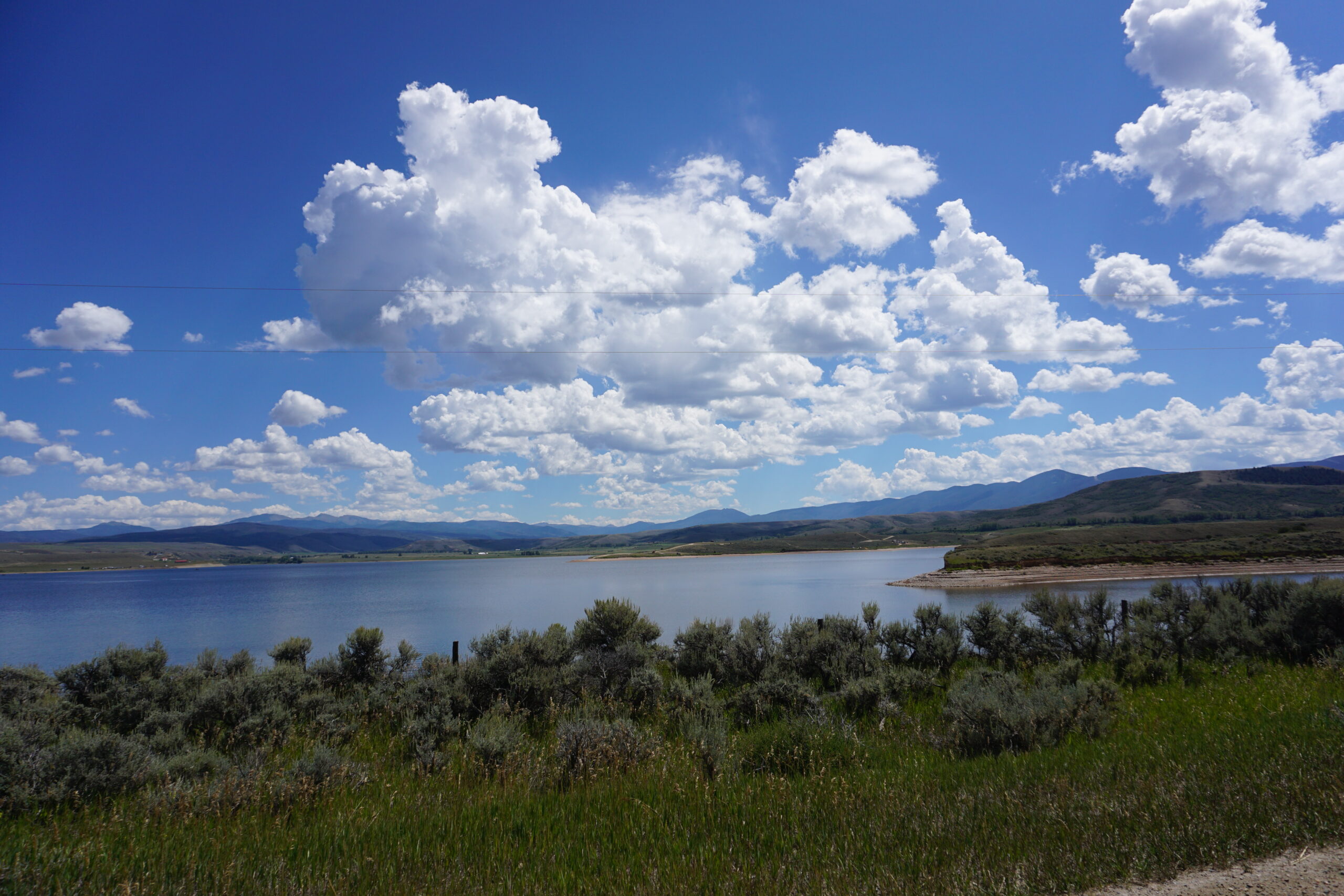
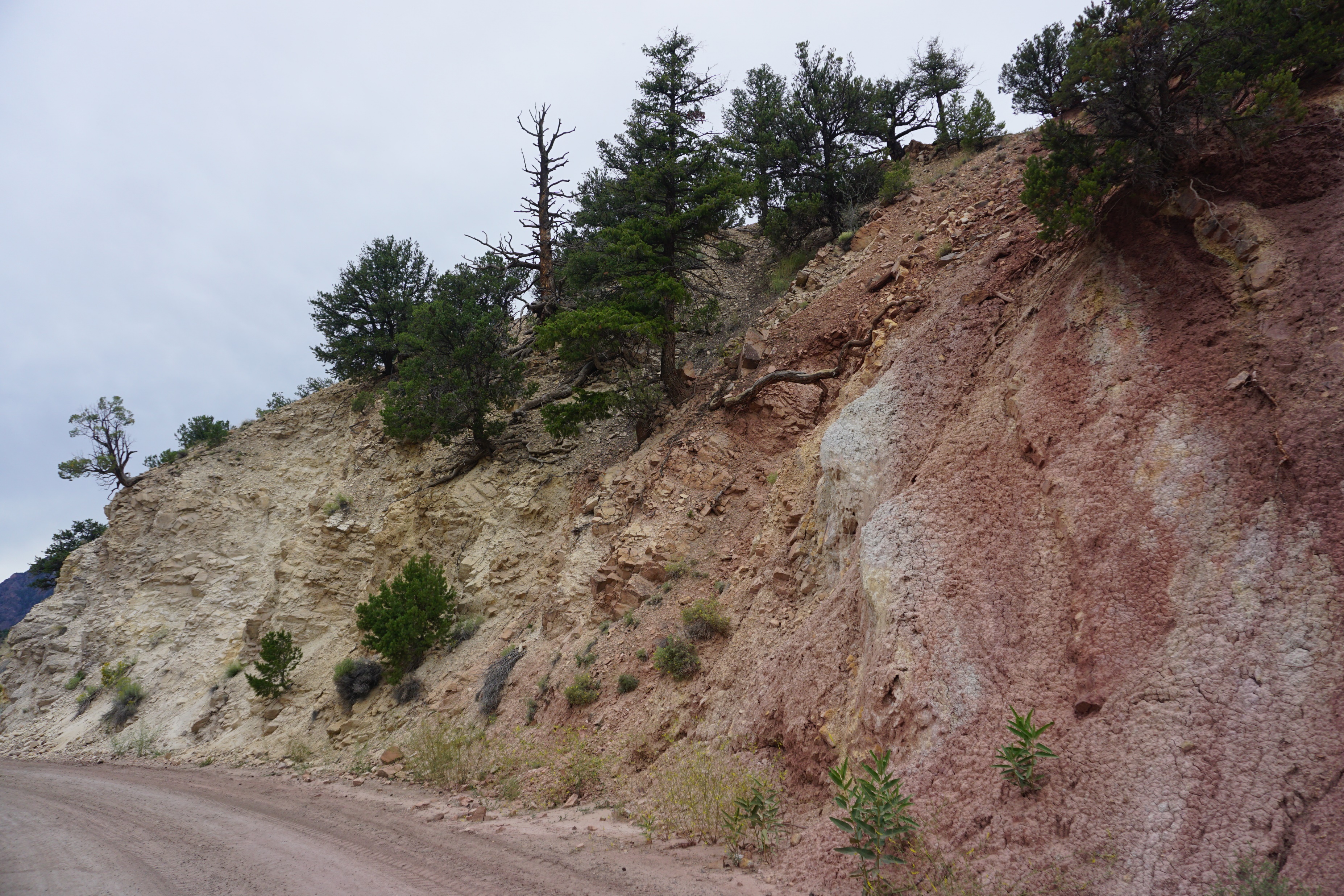
Day 26: This water will make you glow
Today we rode from Steamboat Springs, Colorado, US to Radium, Colorado, US. Sunny weather with clouds, and thunderstorms. Road conditions included gravel roads for most of the day (few kilometer of paved roads). Highlights of the day include seeing some of the rock formations.
Riding statistics: on Friday, August 26, 2022, day 26 on the route, it took 11:02h (07:32h moving time), between 7:18 and 6:20, to cover 101 km (62 miles), including 1539 m (5049 ft) elevation gain, with an average speed of 13.0 km/h (8.1 mph), while reaching a maximum speed of 43 km/h (26.7 mph). During this ride the average temperature was 19 °C (66 °F) with a minimum of 8 °C (46 °F) and a maximum of 32 °C (90 °F).
...
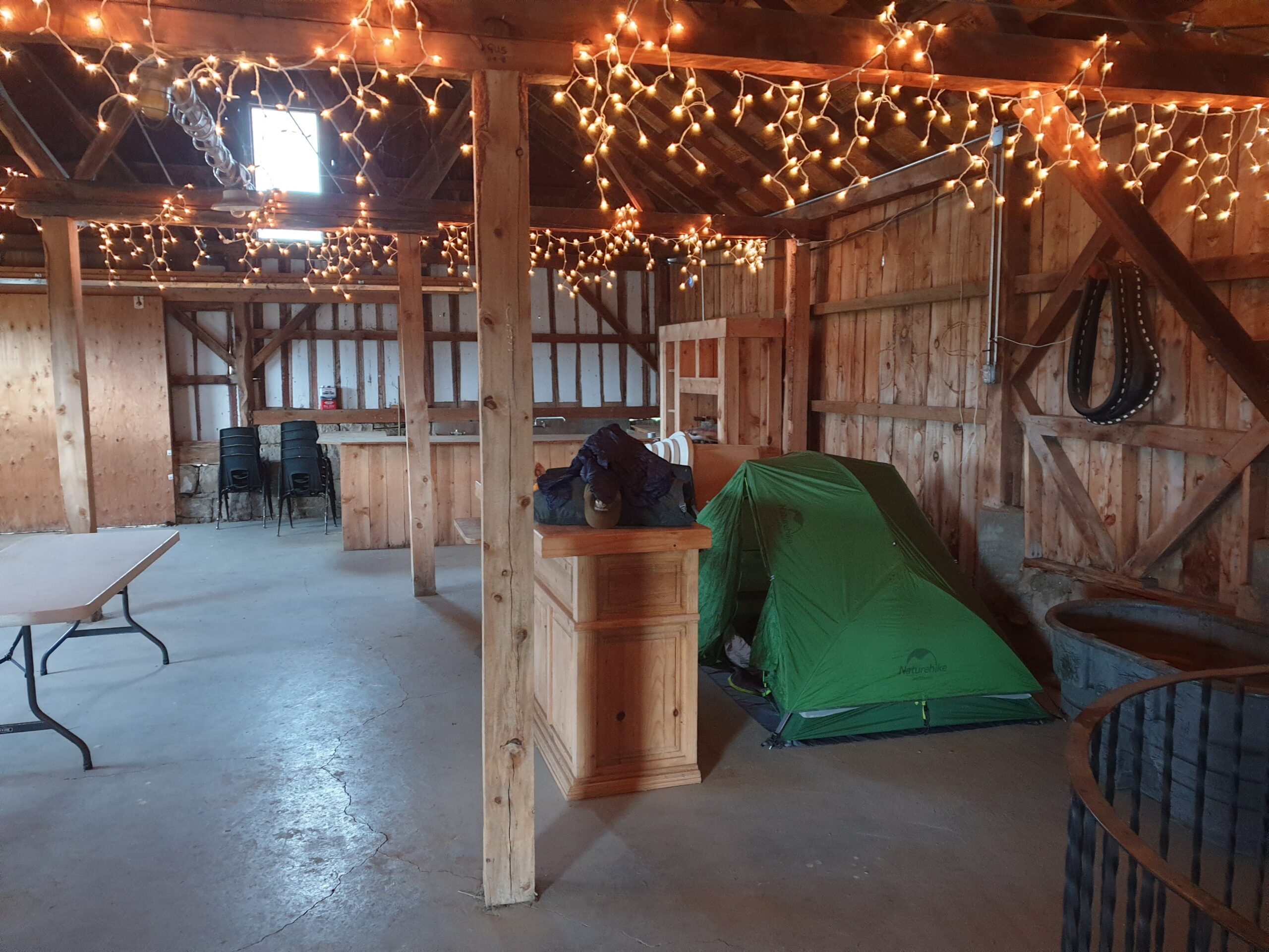
Day 25: Bike maintenance
Today we rode from Brush Mountain Lodge, Colorado, US to Steamboat Springs, Colorado, US. Sunny / overcast weather. Road conditions included mainly gravel roads, and jeep tracks. Highlights of the day include Brush Mountain Lodge.
Riding statistics: on Thursday, August 25, 2022, day 25 on the route, it took 10:38h (06:12h moving time), between 7:28 and 6:07, to cover 79 km (49 miles), including 1004 m (3294 ft) elevation gain, with an average speed of 15.0 km/h (9.3 mph), while reaching a maximum speed of 51 km/h (31.7 mph). During this ride the average temperature was 24 °C (75 °F) with a minimum of 17 °C (63 °F) and a maximum of 33 °C (91 °F).
...
Day 24: Brush Mountain Lodge
Today we rode from the Teton Reservoir Campground 16km south of Rawlins, Wyoming, US to Brush Mountain Lodge, Colorado, US. Sunny weather with clouds. Road conditions included paved roads and gravel roads. Highlights of the day include Brush Mountain Lodge!!.
Riding statistics: on Wednesday, August 24, 2022, day 24 on the route, it took 10:38h (06:12h moving time), between 7:28 and 6:07, to cover 115 km (71 miles), including 1695 m (5561 ft) elevation gain, with an average speed of 14.0 km/h (8.7 mph), while reaching a maximum speed of 71 km/h (44.1 mph). During this ride the average temperature was 30 °C (86 °F) with a minimum of 5 °C (41 °F) and a maximum of 43 °C (109 °F).
...