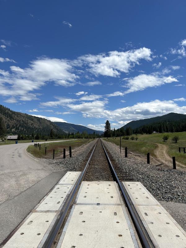
Western Wildlands Route
Admin Jun 17, 2024“The 2,700-mile Western Wildlands Route (WWR, formerly known as the Wild West Route) offers bikepackers a non-technical riding experience through the vast expanses of wild and public lands in the Intermountain West. Nearly 70% of the route is on public lands - 18 National Forests, 6 National Parks and Monuments, and 4 areas with Bureau of Land Management National Conservation Lands designation.”, according to Bikepacking Roots. This route took us 12 days, 8 hours, 40 minutes, and 9 seconds of cycling time to cover 4312 km (2679 miles), including 47660 m (156372.46000000002 ft) elevation gain, with an average speed of 15 km/h (9 mph), reaching a maximum speed of 63 km/h (39 mph) on Saturday, June 1, 2024. During cycling, there was a minimum temperature of 0 °C (32 °F) on Thursday, May 30, 2024, and a maximum temperature of 50 °C (122 °F) on Friday, June 7, 2024.
Continue readingGreat Divide Mountain Bike Route
Admin Sep 12, 2022“The Great Divide Mountain Bike Route (GDMBR) is Adventure Cycling’s premier off-pavement cycling route, crisscrossing the Continental Divide in southern Canada and the U.S. This route is defined by the word “remote”. Its remoteness equates with spectacular terrain and scenery. The entire route is basically dirt road and mountain-pass riding every day. In total, it has over 200,000 feet of elevation gain. Nearly 2,100 miles of the route is composed of County, Forest Service, Bureau of Land Management (BLM), and Canadian provincial unpaved roads.”, according to the Adventure Cycling Association.
Continue readingLatest posts
Day 34: Back to the original route
EvE Jun 11, 2024Today we cycled from the Kreis Pond Campground to a dispersed campsite on the Olympian Trail between St Regius and Haugan. The morning started cloudy, but after a few hours we had lots of sunshine. We rode non-paved most of the day, except between Superior and St Regius. Riding statistics: on Tuesday, June 11, 2024, day 42 on the route, it took 11:02h (07:53h moving time), between 6:56 and 5:59, to cover 110.79423 km (68 miles), including 1501 m (4925 ft) elevation gain, with an average speed of 14.0 km/h (8.7 mph), while reaching a maximum speed of 48 km/h (29.8 mph). During this ride the average temperature was 25 °C (77 °F) with a minimum of 8 °C (46 °F) and a maximum of 46 °C (115 °F).
Continue reading
Day 33: The detour continues
EvE Jun 10, 2024Today we cycled from the Angler’s Roost RV Park in Hamilton to Kreis Pond Campground between Missoula and Superior. We had clouds and sun all day. A little bit of rain when riding out of Missoula. We had a lot of paved roads, but ended the day on gravel. Riding statistics: on Monday, June 10, 2024, day 41 on the route, it took 11:01h (07:50h moving time), between 7:00 and 6:02, to cover 140.5233 km (87 miles), including 672 m (2205 ft) elevation gain, with an average speed of 18.0 km/h (11.2 mph), while reaching a maximum speed of 46 km/h (28.6 mph). During this ride the average temperature was 24 °C (75 °F) with a minimum of 10 °C (50 °F) and a maximum of 35 °C (95 °F).
Continue reading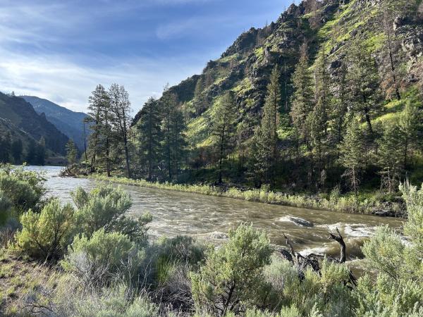
Day 32: Again a huge detour because of snow
EvE Jun 9, 2024Today we cycled from the Spring Creek Campground to Angler’s Roost RV Park close to Hamilton. The day started with sun and dark clouds, which changed to blue skies with a few clouds, and later to very threatening clouds, followed by rain showers and lightning, and finished with threatening clouds and some light rainfall. We cycled on paved roads all day. Riding statistics: on Sunday, June 9, 2024, day 40 on the route, it took 11:38h (07:29h moving time), between 6:35 and 6:14, to cover 137.331 km (85 miles), including 1235 m (4052 ft) elevation gain, with an average speed of 18.0 km/h (11.2 mph), while reaching a maximum speed of 53 km/h (32.9 mph). During this ride the average temperature was 26 °C (79 °F) with a minimum of 12 °C (54 °F) and a maximum of 42 °C (108 °F).
Continue reading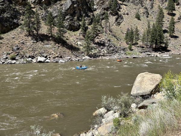
Day 31: From creek to creek to river
EvE Jun 8, 2024Today we cycled from our dispersed campsite at Morgan Creek to Spring Creek campsite. We had blue skies all day, sometimes a little breeze, but it was welcome. We only rode on gravel roads today. Riding statistics: on Saturday, June 8, 2024, day 39 on the route, it took 11:38h (07:29h moving time), between 6:35 and 6:14, to cover 111.37019 km (69 miles), including 832 m (2730 ft) elevation gain, with an average speed of 17.0 km/h (10.6 mph), while reaching a maximum speed of 43 km/h (26.7 mph). During this ride the average temperature was 26 °C (79 °F) with a minimum of 5 °C (41 °F) and a maximum of 43 °C (109 °F).
Continue reading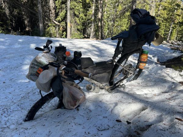
Day 30: More snow, and difficult climbs
EvE Jun 7, 2024Today we cycled from the basic Eightmile Campground between Stanley and Challis to a dispersed campsite at Morgan Creek. We had blue skies, with some friendly clouds all day. We rode almost all day on gravel roads and double-track. Only in Challis we rode on pavement. Riding statistics: on Friday, June 7, 2024, day 38 on the route, it took 11:38h (07:29h moving time), between 6:35 and 6:14, to cover 79.21935 km (49 miles), including 1731 m (5679 ft) elevation gain, with an average speed of 11.0 km/h (6.8 mph), while reaching a maximum speed of 59 km/h (36.7 mph). During this ride the average temperature was 27 °C (81 °F) with a minimum of 1 °C (34 °F) and a maximum of 50 °C (122 °F).
Continue reading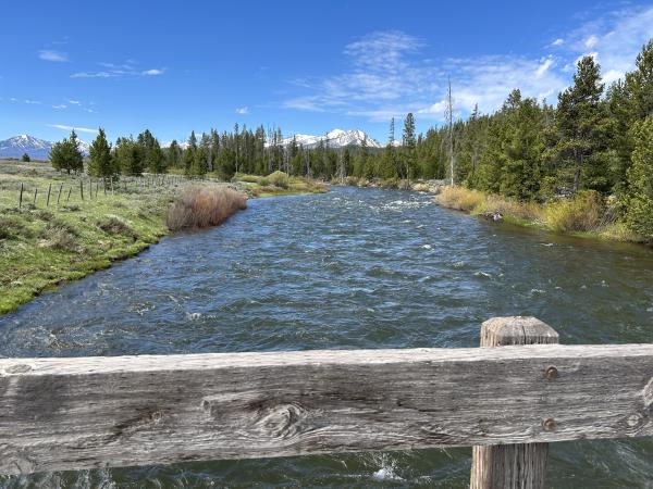
Day 29: The Salmon river and ghost towns
EvE Jun 6, 2024Today we cycled from the dispersed campsite 45km after Ketchum to the basic Eightmile Campground between Stanley and Challis. We started the day with blue skies, during the morning dark clouds formed and started to chase us, in the afternoon it was overcast, with threatening clouds before dinner, and it ended with some clouds and sun until the sun disappeared behind the mountains. We rode mainly on non-paved roads, except for a couple of kilometers in the morning and 20km out of Stanley.
Continue reading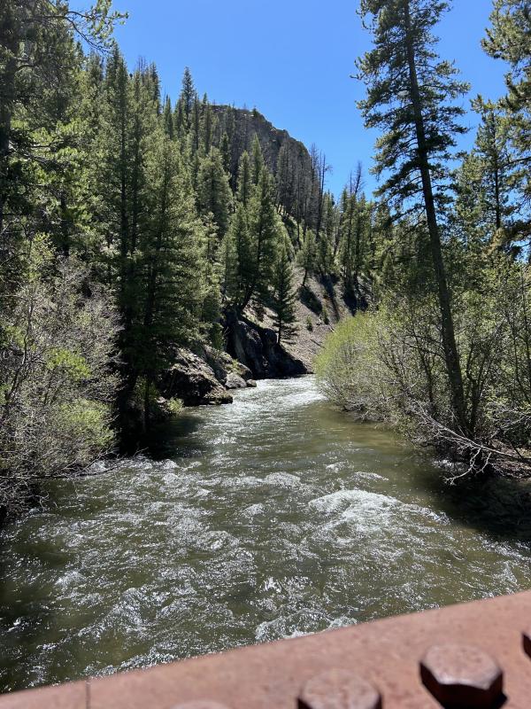
Day 28: The Harimann Trail
EvE Jun 5, 2024Today we cycled from our dispersed campsite 25km before Bellevue to another dispersed campsite 45km after Ketchum. We had blue skies all day, sunny, warm day. Most of the day we have cycled on gravel roads, double-track, single-track, a a bit on pavement. Riding statistics: on Wednesday, June 5, 2024, day 36 on the route, it took 11:38h (07:29h moving time), between 6:35 and 6:14, to cover 100.55701 km (62 miles), including 1241 m (4072 ft) elevation gain, with an average speed of 13.0 km/h (8.1 mph), while reaching a maximum speed of 37 km/h (23.0 mph). During this ride the average temperature was 26 °C (79 °F) with a minimum of 6 °C (43 °F) and a maximum of 48 °C (118 °F).
Continue readingAbout
This is my personal blog on which I keep family and friends updated about my bikepacking adventures.