Western Wildlands Route
Admin Jun 17, 2024“The 2,700-mile Western Wildlands Route (WWR, formerly known as the Wild West Route) offers bikepackers a non-technical riding experience through the vast expanses of wild and public lands in the Intermountain West. Nearly 70% of the route is on public lands - 18 National Forests, 6 National Parks and Monuments, and 4 areas with Bureau of Land Management National Conservation Lands designation.”, according to Bikepacking Roots. This route took us 12 days, 8 hours, 40 minutes, and 9 seconds of cycling time to cover 4312 km (2679 miles), including 47660 m (156372.46000000002 ft) elevation gain, with an average speed of 15 km/h (9 mph), reaching a maximum speed of 63 km/h (39 mph) on Saturday, June 1, 2024. During cycling, there was a minimum temperature of 0 °C (32 °F) on Thursday, May 30, 2024, and a maximum temperature of 50 °C (122 °F) on Friday, June 7, 2024.
Continue readingGreat Divide Mountain Bike Route
Admin Sep 12, 2022“The Great Divide Mountain Bike Route (GDMBR) is Adventure Cycling’s premier off-pavement cycling route, crisscrossing the Continental Divide in southern Canada and the U.S. This route is defined by the word “remote”. Its remoteness equates with spectacular terrain and scenery. The entire route is basically dirt road and mountain-pass riding every day. In total, it has over 200,000 feet of elevation gain. Nearly 2,100 miles of the route is composed of County, Forest Service, Bureau of Land Management (BLM), and Canadian provincial unpaved roads.”, according to the Adventure Cycling Association.
Continue readingLatest posts
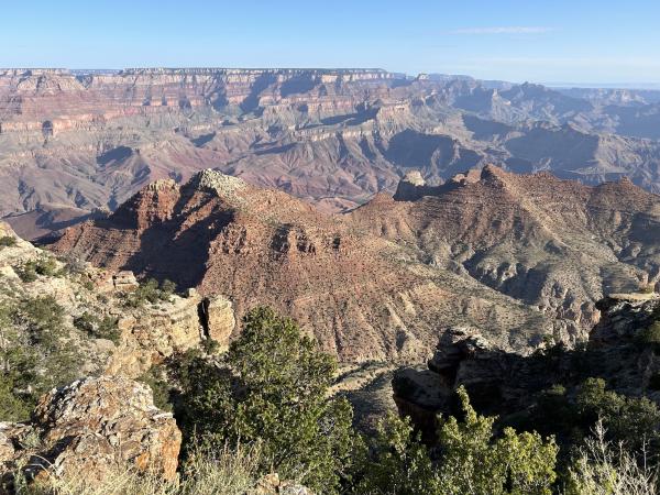
Day 13: Cycling around the Grand Canyon
EvE May 21, 2024Today we rode from the dispersed campsite close to Grand Canyon National Park to another dispersed campsite on the Navajo territory after Cameron. Today with blue skies to start and end the day, during the day we had some clouds. Overall warm but not too warm. Most of the day we rode on a paved road, except for a few kilometers where we entered Grand Canyon National Park, and the Navajo territory.
Continue reading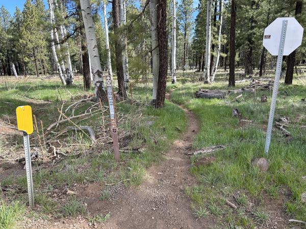
Day 12: Single-track on the Arizona Trail
EvE May 20, 2024Today we rode from a dispersed campsite north of Flagstaff to another dispersed campsite just outside Grand Canyon National Park. Today we mainly had overcast, it started an ended with additional sunshine between the clouds. There was also an very strong wind, with powerful gusts, all day long. The roads were not easy today. Some difficult trails with rocks, dried clay, gravel, and single-track. Riding statistics: on Monday, May 20, 2024, day 20 on the route, it took 10:38h (08:34h moving time), between 6:05 and 4:43, to cover 109.45044 km (68 miles), including 1354 m (4442 ft) elevation gain, with an average speed of 13.0 km/h (8.1 mph), while reaching a maximum speed of 46 km/h (28.6 mph). During this ride the average temperature was 20 °C (68 °F) with a minimum of 12 °C (54 °F) and a maximum of 29 °C (84 °F).
Continue reading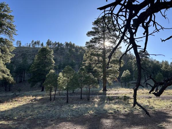
Day 11: Passing Flagstaff
EvE May 19, 2024Today we rode from a dispersed campsite at the top of Schnelby Hill north of Sedona to another dispersed campsite north of Flagstaff. We had blue skies all day, however, because of the elevation and wind it was never too warm. We had some rough roads today, combined with nice gravel roads and a little pavement. Riding statistics: on Sunday, May 19, 2024, day 19 on the route, it took 10:58h (07:01h moving time), between 5:52 and 4:51, to cover 89.60821 km (55 miles), including 1276 m (4187 ft) elevation gain, with an average speed of 13.0 km/h (8.1 mph), while reaching a maximum speed of 43 km/h (26.7 mph). During this ride the average temperature was 22 °C (72 °F) with a minimum of 5 °C (41 °F) and a maximum of 34 °C (93 °F).
Continue reading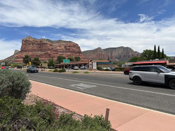
Day 10: The beautiful but challenging Schnebly Hill
EvE May 18, 2024Today we rode from the Sunrise Resort RV Park close to Happy Jack to a dispersed campsite at the top of Sedona’s Schnebly Hill. We started with blue skies, had some clouds during the morning, and ended the day again with a clear sky. The road surfaces today were either paved or very rough off-road. Riding statistics: on Saturday, May 18, 2024, day 18 on the route, it took 11:40h (08:40h moving time), between 6:14 and 5:55, to cover 103.63061 km (64 miles), including 1280 m (4200 ft) elevation gain, with an average speed of 14.0 km/h (8.7 mph), while reaching a maximum speed of 48 km/h (29.8 mph). During this ride the average temperature was 28 °C (82 °F) with a minimum of 5 °C (41 °F) and a maximum of 47 °C (117 °F).
Continue reading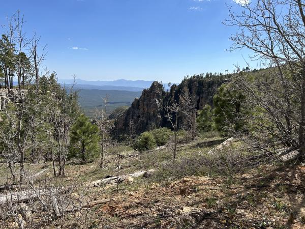
Day 09: The Mogollon Mountains
EvE May 17, 2024Today we rode from a dispersed campsite north of Young to the Sunrise Resort RV park. We had blue skies starting the day, some clouds during the day, and again a clear sky in the evening. The road surface was mainly gravel, some double-track, and very little pavement. Riding statistics: on Friday, May 17, 2024, day 17 on the route, it took 11:40h (08:40h moving time), between 6:14 and 5:55, to cover 117.42279 km (73 miles), including 1502 m (4928 ft) elevation gain, with an average speed of 14.0 km/h (8.7 mph), while reaching a maximum speed of 45 km/h (28.0 mph). During this ride the average temperature was 23 °C (73 °F) with a minimum of 8 °C (46 °F) and a maximum of 33 °C (91 °F).
Continue reading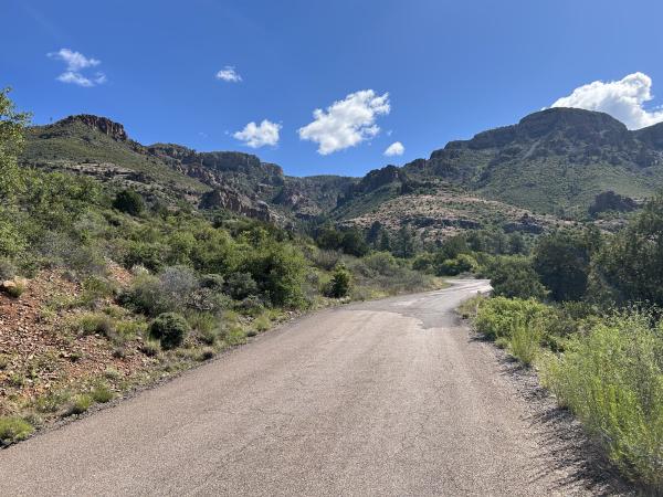
Day 08: Higher elevations
EvE May 16, 2024Today we rode from a dispersed campsite at the Salty River to another dispersed campsite 15km north of Young. The day started with blue skies, later clouds, sometimes dark clouds in the mountains, and some rain in the evening. The road surfaces was about 50/50 paved vs non-paved. Riding statistics: on Thursday, May 16, 2024, day 16 on the route, it took 11:29h (08:16h moving time), between 6:27 and 5:57, to cover 89.88381 km (55 miles), including 2341 m (7681 ft) elevation gain, with an average speed of 10.0 km/h (6.2 mph), while reaching a maximum speed of 56 km/h (34.8 mph). During this ride the average temperature was 25 °C (77 °F) with a minimum of 17 °C (63 °F) and a maximum of 33 °C (91 °F).
Continue reading
Day 07: Swim and camp with kind locals
EvE May 15, 2024Today we rode from our dispersed campsite in the Pina Mountains to a dispersed campsite at the Salty River. We again had hot weather with barely any clouds. The road surface, yeah, a barely rideable double-track with rocks and loose gravel, to nice gravel, and also pavement. Riding statistics: on Wednesday, May 15, 2024, day 15 on the route, it took 11:29h (08:16h moving time), between 6:27 and 5:57, to cover 68.73069 km (42 miles), including 1215 m (3986 ft) elevation gain, with an average speed of 12.0 km/h (7.5 mph), while reaching a maximum speed of 54 km/h (33.6 mph). During this ride the average temperature was 29 °C (84 °F) with a minimum of 13 °C (55 °F) and a maximum of 38 °C (100 °F).
Continue readingAbout
This is my personal blog on which I keep family and friends updated about my bikepacking adventures.