Today we cycled from the dispersed campsite 45km after Ketchum to the basic Eightmile Campground between Stanley and Challis. We started the day with blue skies, during the morning dark clouds formed and started to chase us, in the afternoon it was overcast, with threatening clouds before dinner, and it ended with some clouds and sun until the sun disappeared behind the mountains. We rode mainly on non-paved roads, except for a couple of kilometers in the morning and 20km out of Stanley.
Riding statistics: on Thursday, June 6, 2024, day 37 on the route, it took 11:38h (07:29h moving time), between 6:35 and 6:14, to cover 109.58529 km (68 miles), including 1140 m (3740 ft) elevation gain, with an average speed of 15.0 km/h (9.3 mph), while reaching a maximum speed of 41 km/h (25.5 mph). During this ride the average temperature was 23 °C (73 °F) with a minimum of 11 °C (52 °F) and a maximum of 43 °C (109 °F).
Totals: So far, it took 9 days, 3 hours, 18 minutes, and 42 seconds of cycling time to cover 3136 km (1949 miles), including 34101 m (111885 ft) elevation gain, with an average speed of 14.5 km/h (9.0 mph).
When we got out of our tents this morning, everything was soaking wet from the damp. With the cold temperatures and close to a stream, the outer tent gets completely wet. And when breaking down the tent, ice formed on the outer tent. We quickly stored everything on the bikes and started cycling to get warmed up. We took the main road because we have not been able to find any trail as part of the Old Stagecoach Route. It was about 7km to the top of the pass, and after a few turns we rode in the sunlight. That felt good. Better, quite soon it was that warm that I already could get rid of the jacket. Just after the pass we could continue on the second part of the Old Stagecoach Route. That was easy to find, it was even open to motorized vehicles. A very nice double-track, with amazing views. It also went through the forest. So, we had as much fun as yesterday on the Harimann Trail. We could continue the track all the way to the little town of Stanley. Somewhere halfway to Stanley one of the front racks of Fons bike fell off. Two of three bolts had disappeared, and the third connection eventually broke. I had a spare bolt, and it has been fixed with two bolts for now. However, I think it will need a better fix soon.
When we arrived at Stanley, all I could see were a few buildings related to tourists. Mercantile, gas station, restaurant, motel, etc. I did not see many normal houses. I guess they were there, but not in sight. The reason I think that is, when we rode out of town we saw an Adopt-a-Highway sign, with the sponsor being ‘Taekwondo club Stanley‘. We bought a few groceries, not much, because we still had sufficient for tomorrow. At the gas station I got an ice cream and iced coffee.
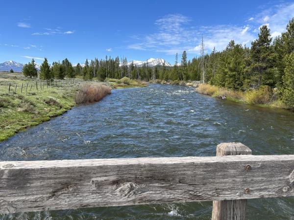
We left Stanley on a paved road, very quiet, so an easy ride. We followed the Salmon River most of the day, also when riding out of Stanley. After about 20km we took a left onto an even more quiet road, wellicht eventually became a gravel road. Quiet, and beautiful views in the canyon we were riding. After a while we passed through some ghost towns (or at at least the remains), Bonzana Ghost town and Custer City Ghost town. Both remains from the Gold Fever time. There was also a big Mining Dredge. Spectacular to see something like that in the current environment.
After a bit more riding and climbing mountains, we arrived at the very basic Eightmile Campground (only a pit toilet). Here I changed the chain of my bike. It was time to start using a new one. The old one has seen a lot of dust, especially in Arizona. After that we ate dinner, hung our food, and got some rest. For your information: we will be more remote and have longer sections between re-supply. This means there may be less frequent updates coming week.
