“The 2,700-mile Western Wildlands Route (WWR, formerly known as the Wild West Route) offers bikepackers a non-technical riding experience through the vast expanses of wild and public lands in the Intermountain West. Nearly 70% of the route is on public lands - 18 National Forests, 6 National Parks and Monuments, and 4 areas with Bureau of Land Management National Conservation Lands designation.”, according to Bikepacking Roots.
Totals: This route took us 12 days, 8 hours, 40 minutes, and 9 seconds of cycling time to cover 4312 km (2679 miles), including 47660 m (156372 ft) elevation gain, with an average speed of 15 km/h (9 mph), reaching a maximum speed of 63 km/h (39 mph) on Saturday, June 1, 2024. During cycling, there was a minimum temperature of 0 °C (32 °F) on Thursday, May 30, 2024, and a maximum temperature of 50 °C (122 °F) on Friday, June 7, 2024.
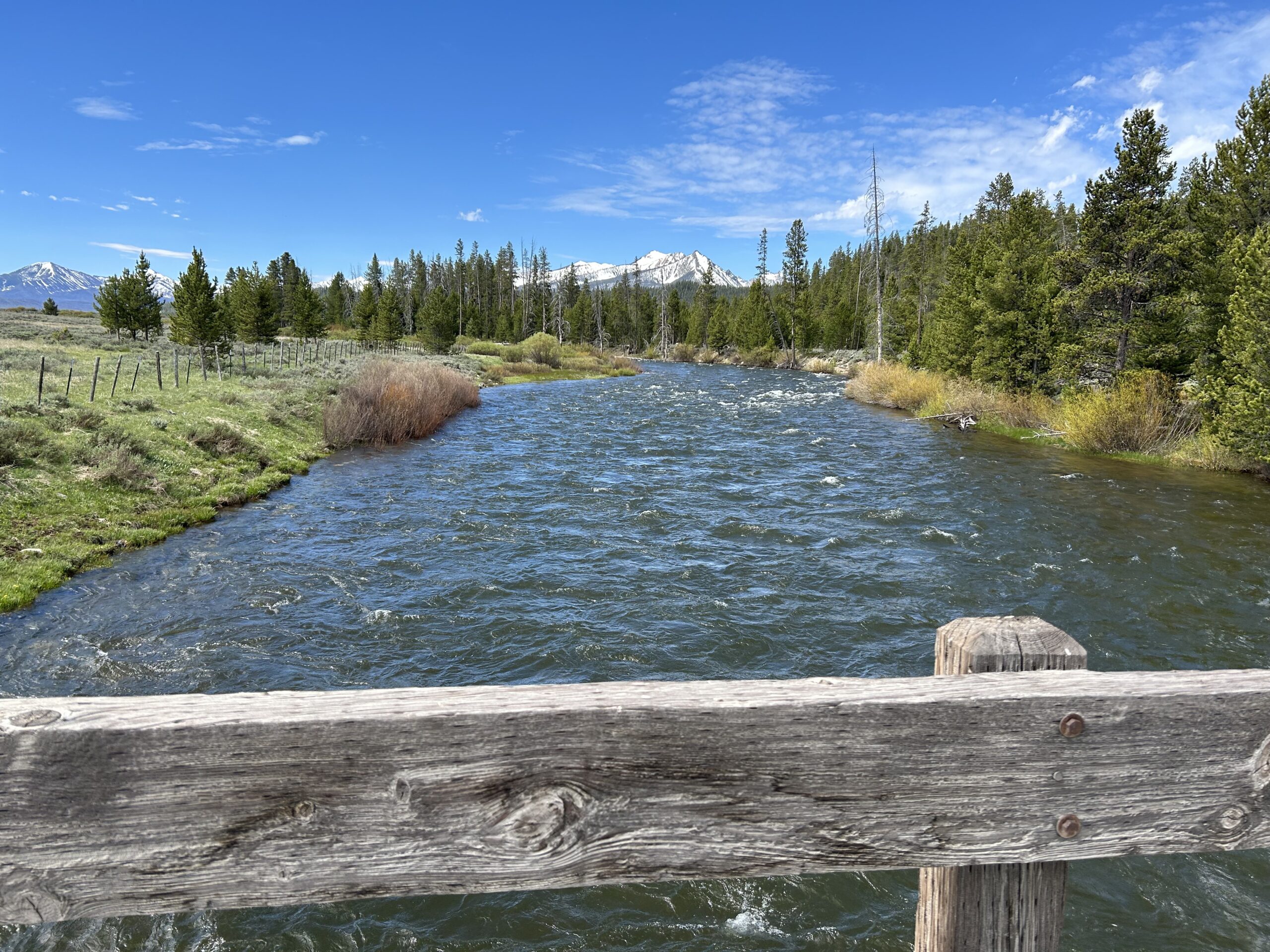
Today we cycled from our dispersed campsite at Morgan Creek to Spring Creek campsite. We had blue skies all day, sometimes a little breeze, but it was welcome. We only rode on gravel roads today.
Riding statistics: on Saturday, June 8, 2024, day 39 on the route, it took 11:38h (07:29h moving time), between 6:35 and 6:14, to cover 111 km (69 miles), including 832 m (2730 ft) elevation gain, with an average speed of 17.0 km/h (10.6 mph), while reaching a maximum speed of 43 km/h (26.7 mph). During this ride the average temperature was 26 °C (79 °F) with a minimum of 5 °C (41 °F) and a maximum of 43 °C (109 °F).
...
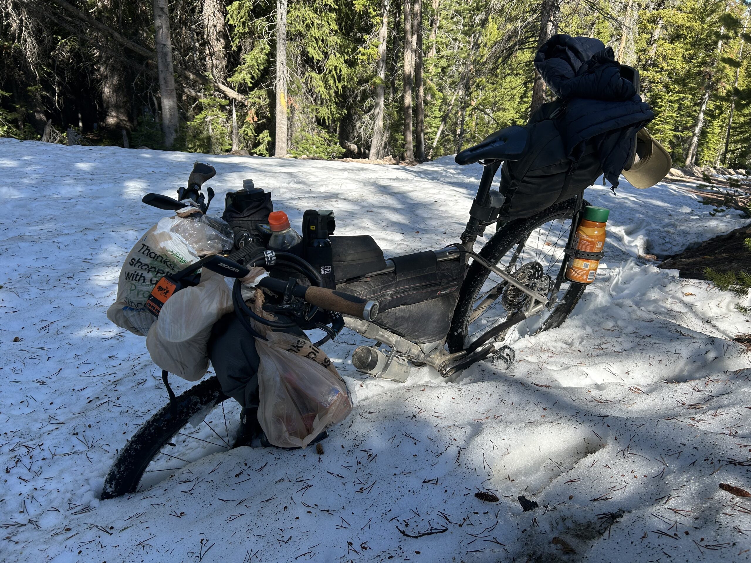
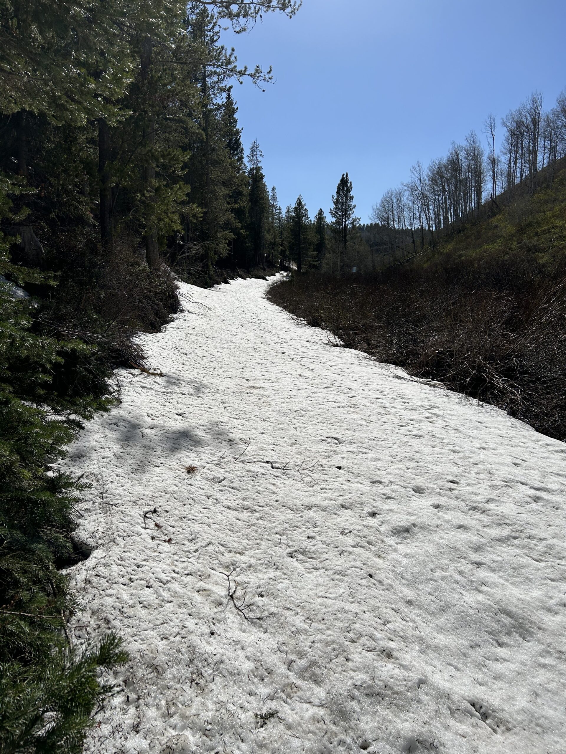
Day 30: More snow, and difficult climbs
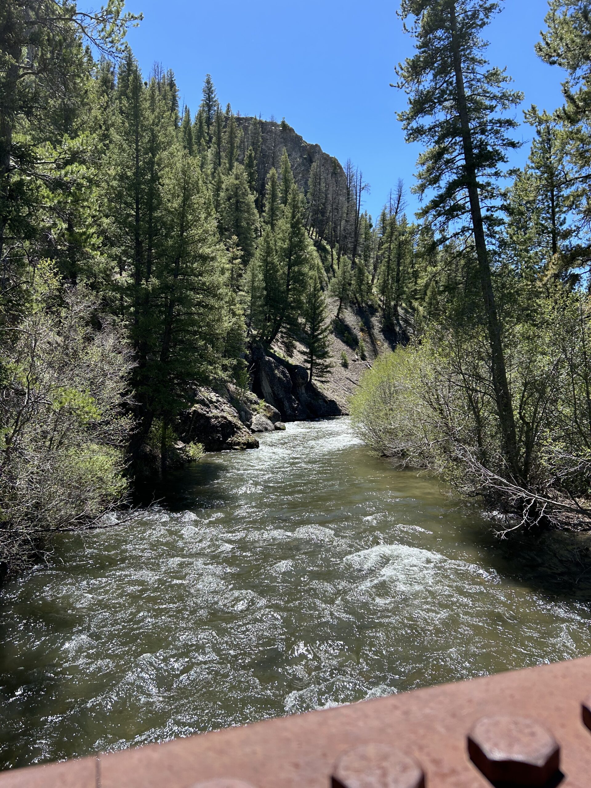
Today we cycled from the basic Eightmile Campground between Stanley and Challis to a dispersed campsite at Morgan Creek. We had blue skies, with some friendly clouds all day. We rode almost all day on gravel roads and double-track. Only in Challis we rode on pavement.
Riding statistics: on Friday, June 7, 2024, day 38 on the route, it took 11:38h (07:29h moving time), between 6:35 and 6:14, to cover 79 km (49 miles), including 1731 m (5679 ft) elevation gain, with an average speed of 11.0 km/h (6.8 mph), while reaching a maximum speed of 59 km/h (36.7 mph). During this ride the average temperature was 27 °C (81 °F) with a minimum of 1 °C (34 °F) and a maximum of 50 °C (122 °F).
...
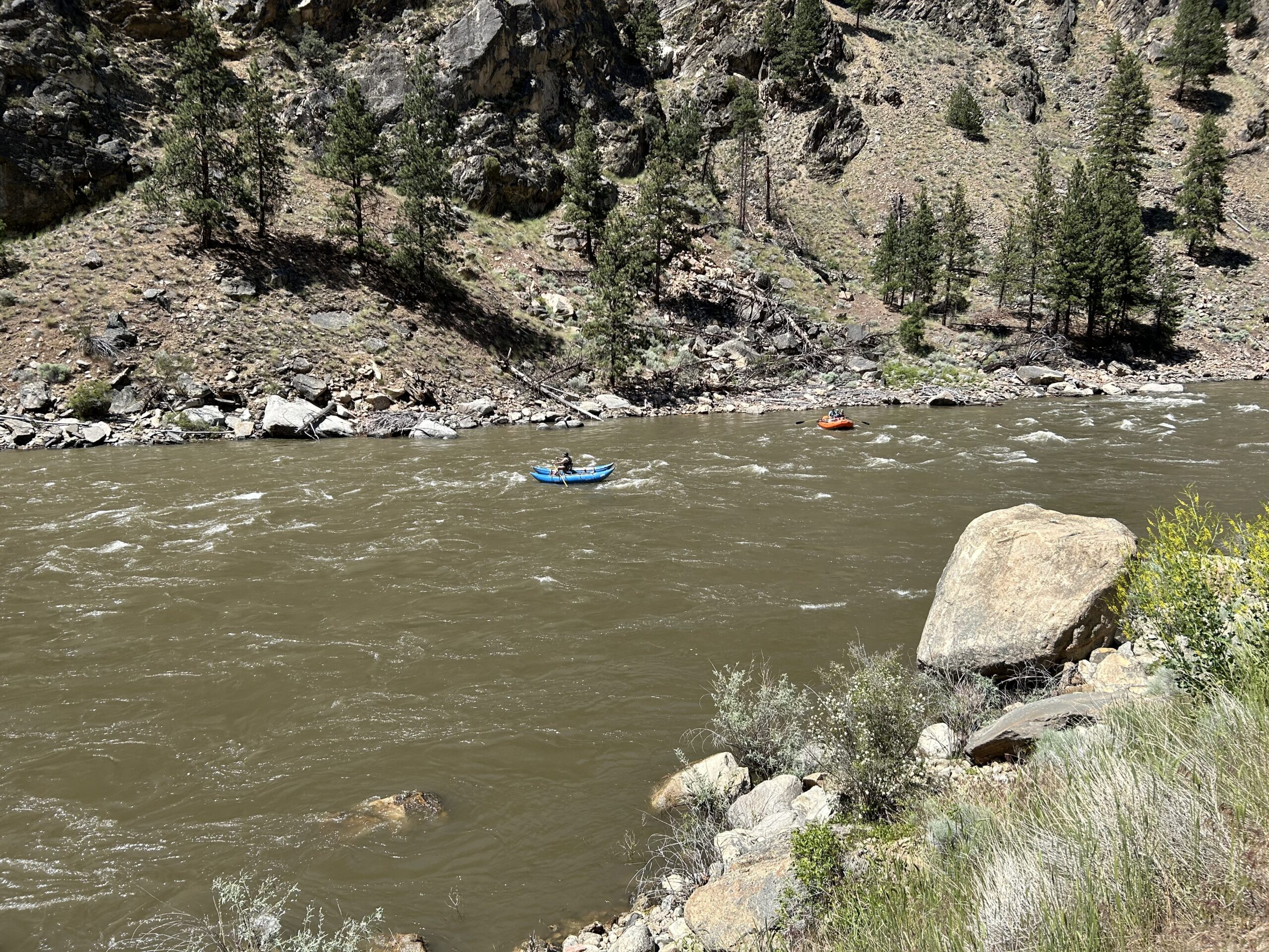
Day 29: The Salmon river and ghost towns
Today we cycled from the dispersed campsite 45km after Ketchum to the basic Eightmile Campground between Stanley and Challis. We started the day with blue skies, during the morning dark clouds formed and started to chase us, in the afternoon it was overcast, with threatening clouds before dinner, and it ended with some clouds and sun until the sun disappeared behind the mountains. We rode mainly on non-paved roads, except for a couple of kilometers in the morning and 20km out of Stanley.
...
Day 28: The Harimann Trail
Today we cycled from our dispersed campsite 25km before Bellevue to another dispersed campsite 45km after Ketchum. We had blue skies all day, sunny, warm day. Most of the day we have cycled on gravel roads, double-track, single-track, a a bit on pavement.
Riding statistics: on Wednesday, June 5, 2024, day 36 on the route, it took 11:38h (07:29h moving time), between 6:35 and 6:14, to cover 101 km (62 miles), including 1241 m (4072 ft) elevation gain, with an average speed of 13.0 km/h (8.1 mph), while reaching a maximum speed of 37 km/h (23.0 mph). During this ride the average temperature was 26 °C (79 °F) with a minimum of 6 °C (43 °F) and a maximum of 48 °C (118 °F).
...
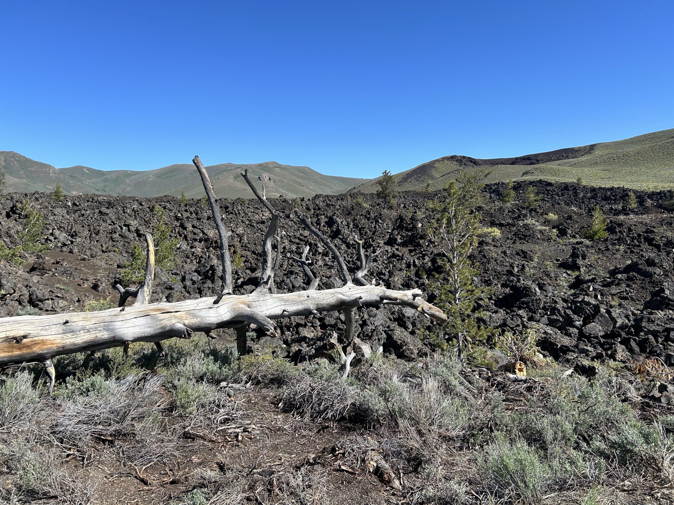
Day 27: That poor snake
Today we rode from the Mountain View RV Park to a dispersed campsite 25km before Bellevue (just before a large climb). The weather was great again, blue skies, with only a few clouds, warm temps, strong winds. Most of the day was on non-paved, a section at Craters of the Moon National Monument and Preserve was paved highway.
Riding statistics: on Thursday, January 1, 1970, day 35 on the route, it took 07:01h (06:03h moving time), between 6:36 and 1:38, to cover 0 km (0 miles), including 0 m (0 ft) elevation gain, with an average speed of %!f(int=0) km/h (%!f(int=0) mph), while reaching a maximum speed of 0 km/h (%!f(int=0) mph). During this ride the average temperature was 0 °C (0 °F) with a minimum of 0 °C (0 °F) and a maximum of 0 °C (0 °F).
...
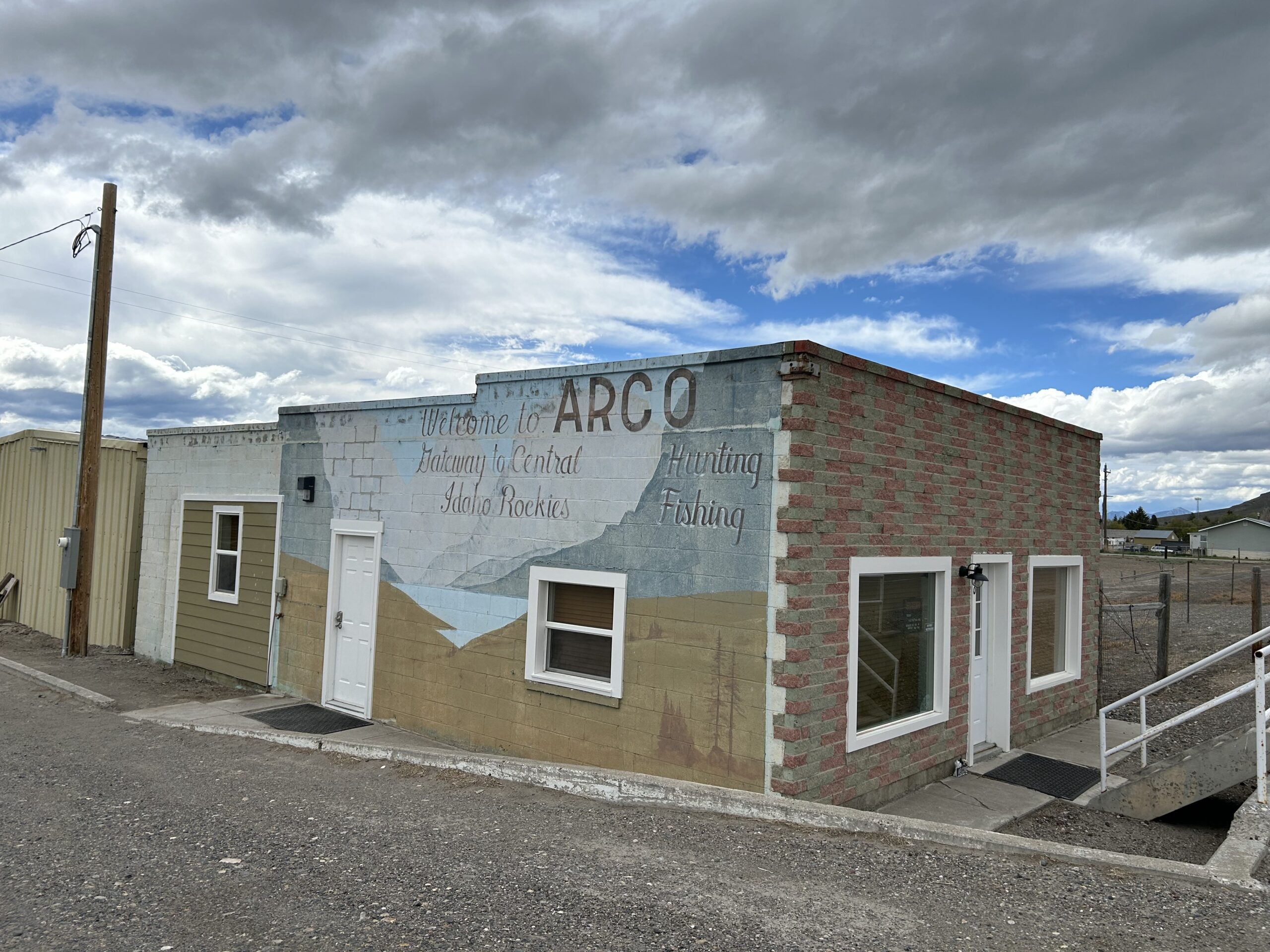
Day 26: Lava country, and rain
Today we cycled from our dispersed campsite 30km after Blackfoot to the Mountain View RV Park in Arco. We had threatening clouds all day, got rained on for about 45 minutes in total, had again super strong winds, and a little bit of sun in the late afternoon. Except for riding into town, we only got, sometimes difficult, double-track.
Riding statistics: on Monday, June 3, 2024, day 34 on the route, it took 07:01h (06:03h moving time), between 6:36 and 1:38, to cover 82 km (51 miles), including 599 m (1965 ft) elevation gain, with an average speed of 14.0 km/h (8.7 mph), while reaching a maximum speed of 34 km/h (21.1 mph). During this ride the average temperature was 14 °C (57 °F) with a minimum of 11 °C (52 °F) and a maximum of 19 °C (66 °F).
...
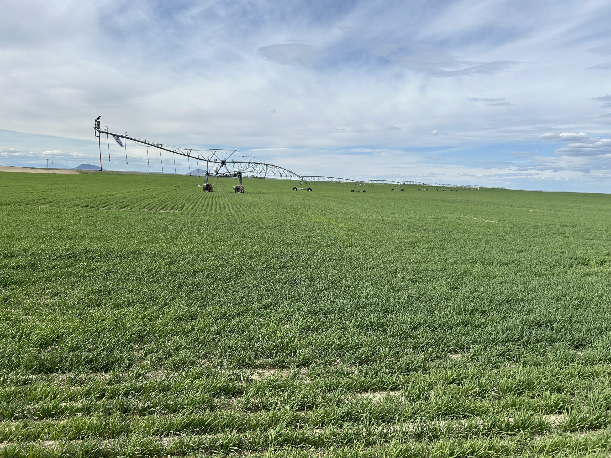
Day 25: Idaho grasslands, and a brutal headwind
Today we rode from the simple Sagehen Flat campground to a dispersed campsite 30km after Blackfoot. Today we got a cloudy day but also a (less warm) sun was shining. The road surfaces today were paved and non-paved 50/50.
Riding statistics: on Sunday, June 2, 2024, day 33 on the route, it took 11:07h (08:16h moving time), between 6:51 and 5:59, to cover 119 km (74 miles), including 841 m (2759 ft) elevation gain, with an average speed of 14.0 km/h (8.7 mph), while reaching a maximum speed of 60 km/h (37.3 mph). During this ride the average temperature was 23 °C (73 °F) with a minimum of 8 °C (46 °F) and a maximum of 32 °C (90 °F).
...
Day 24: Entering Idaho
Today we rode from our dispersed campsite near the Smokey Canyon Mine to Sagehen Flat campground between Soda Springs and Blackfoot. The day started with blue skies but soon clouds formed above the mountains, there seemed to be rain behind us, but we only got threatening clouds in the afternoon, and eventually friendly clouds with some sunshine to end the day. We have cycled mostly on gravel and some double-track.
...
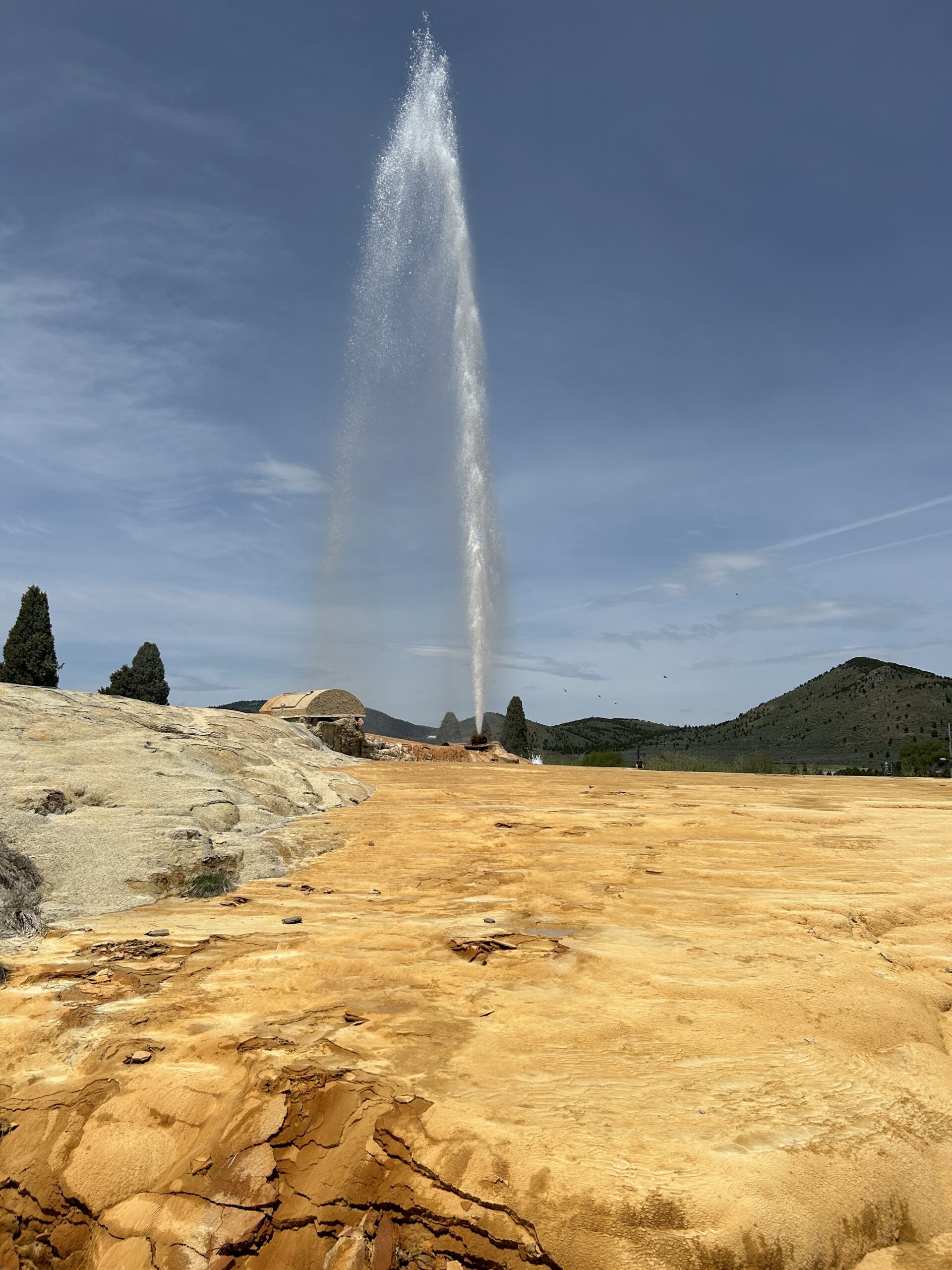
Day 23: The snow got us again
Today we rode from the North Eden campground in the Bear Lake State Park to a dispersed campsite 1km after the Smokey Canyon Mine, and 3km before the top of a pass. We mostly cycled on gravel today. The weather was a clear blue sky all day, plus a bit of a sometimes chilly wind.
Riding statistics: on Friday, May 31, 2024, day 31 on the route, it took 11:07h (08:16h moving time), between 6:51 and 5:59, to cover 101 km (62 miles), including 1531 m (5023 ft) elevation gain, with an average speed of 12.0 km/h (7.5 mph), while reaching a maximum speed of 53 km/h (32.9 mph). During this ride the average temperature was 22 °C (72 °F) with a minimum of 4 °C (39 °F) and a maximum of 39 °C (102 °F).
...
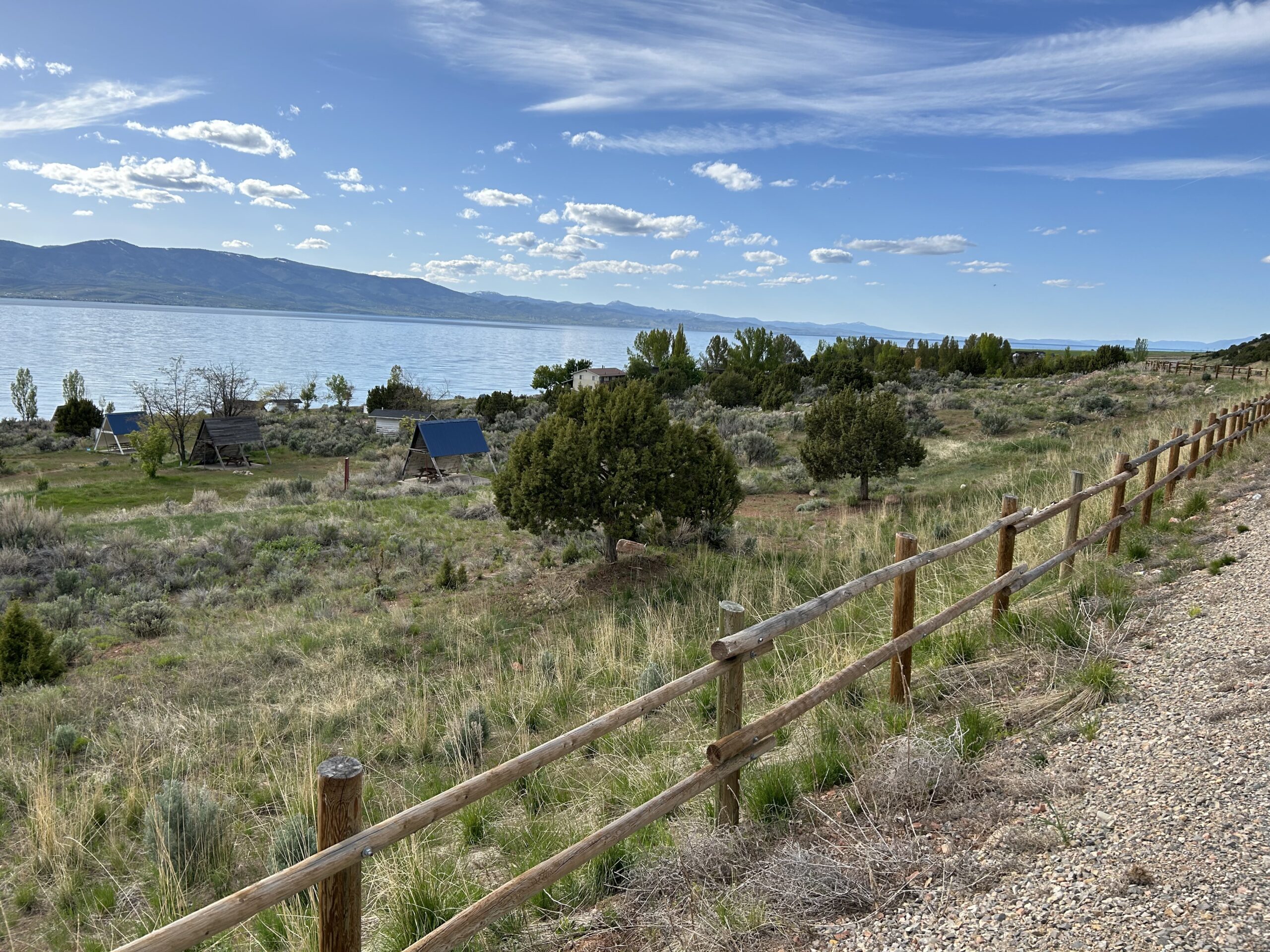
Day 22: Wyoming, Utah, Wyoming, Utah
Today we rode from the Phillips RV Park in Evanston to the North Eden campground at Bear Lake. Today we had beautiful weather with blue skies and a few clouds. We did have the colder wind again. The road surface was mainly on gravel and double-track, and some pavement.
Riding statistics: on Thursday, May 30, 2024, day 30 on the route, it took 12:17h (08:45h moving time), between 6:44 and 7:02, to cover 140 km (87 miles), including 1108 m (3635 ft) elevation gain, with an average speed of 16.0 km/h (9.9 mph), while reaching a maximum speed of 57 km/h (35.4 mph). During this ride the average temperature was 19 °C (66 °F) with a minimum of 1 °C (34 °F) and a maximum of 28 °C (82 °F).
...